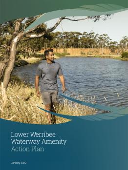
The Lower Werribee Waterway Amenity Action Plan (LWWAAP) articulates a 10-year vision for improved amenity, cultural values, community access and visitor experience along the Wirribi Yaluk (Werribee River) corridor, and provides prioritised actions to achieve this.
The plan is the result of a collaborative partnership of Traditional Owners, government and community organisations, and responds to the need for better blue-green spaces in Melbourne’s growing west.
Download the plan
Read the full plan below, or explore it visually and geographically using the LWWAAP interactive spatial tool .
Background
Access to waterway and open space corridors are vital to community health and wellbeing, and offer opportunities for enhanced physical activity, escape to nature, and social connection. They also provide cool green spaces within our cities, which are ever more important in the face of climate change.
The LWWAAP is an action from the Waterways of the West Action Plan, released by the Victorian Government in December 2021, which highlights the importance of waterway amenity for the west’s growing population.
Developing the plan
The LWWAAP has been co-designed by a collaborative partnership and informed by community feedback, background studies, and complementary strategies and policies already in operation for the Lower Wirribi Yaluk.
It demonstrates coordinated waterway and catchment management between the following partners:
- Bunurong Land Council Aboriginal Corporation
- Department of Environment, Land, Water and Planning
- Melbourne Water
- Parks Victoria
- Wadawurrung Traditional Owners Aboriginal Corporation
- Werribee Open Range Zoo
- Werribee River Association
- Western Melbourne Tourism Inc.
- Wyndham City Council.
Delivering the plan
Now that the plan has been finalised and endorsed by project partners, we move into the important and exciting implementation phase.
The LWWAAP will deliver on-the-ground improvements including:
- linking gaps in the path network to provide a continuous trail along the river, from Davis Creek to the river mouth
- more river access points to support on-water and beside-water activities such as kayaking
- improved open space facilities to provide a better range and quality of recreation
- interpretive and wayfinding signage to convey the rich heritage and stories of the river
- increased riparian vegetation and tree planting for enhanced biodiversity and urban cooling.
As actions in the LWWAAP are implemented, the lead agency will engage the local community with opportunities to provide input on different aspects of each project. If you have an interest in collaborating with our working group, please contact us.
Contact
For more information:
You may also like...
Learn more about the plan or explore key actions, using the map-based interactive spatial tool.
Download the plan from the Department of Environment, Land, Water and Planning website.
